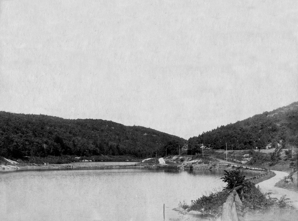
Modern day Route 23 was established in 1927 to run from Verona to the New York border near Port Jervis, which replaced Route 8 that previously ran between Verona and Sussex. The route followed two turnpikes that were created in the early 19th century: the Newark-Pompton Turnpike and the Paterson-Hamburg Turnpike. Their purpose at that time was to provide a good solid highway for transporting iron ore, timber, and agricultural commodities from northern New Jersey to the commercialized sections of Passaic County.
In 1806 toll roads were built with one leg running through Newfoundland. A 1819 account of the turnpike system written by E. Hewitt commented that “The roads are terrible and the bridges over the small streams nothing more than poles laid across”. Since they charged tolls, the turnpike had income to improve its facilities, and from 1806 to about 1814, the Paterson-Hamburg Turnpike was graded, improved, and new bridges and other amenities constructed. The combination of these two roads would become present day Route 23 with the Paterson-Hamburg Turnpike running past the Oak Ridge Reservoir.
By 1889, the City of Newark began acquisition and construction of its reservoir system, and one of the first ones it built was at a spot where the Pequannock passed by the little village of Oak Ridge. At one time, prior to the reservoir, there stood the hamlet of Wallace Corner and the original village of Oak Ridge. Both are long gone, torn down with their locations submerged beneath the reservoir.
In the mid-1950s, there were plans to build an Interstate Highway along Route 23 between Interstate 80 and Interstate 287, but it was never built. In the 1960s, the route was planned to be upgraded to a freeway all the way up to Port Jervis and south to Piscataway, Middlesex County; however, both freeway proposals were cancelled in the early 1970s. In the mid-1980s, the portion of Route 23 from north of U.S. Route 46 in Wayne to Interstate 287 in Riverdale was improved, with the road upgraded to a six-lane freeway south of the Alps Road intersection and to a six-lane surface road north of Alps Road.

5 Comments
The postcard photo above shows the Paterson-Hamburg Tpke. (now Route 23) at the northern end of the reservoir. The roadway was eventually widened and straightened, as well as elevated to the level of the railroad (the ridge, seen at right).
Also visible, crossing the reservoir at a right angle to the roadway, is the top of the original stone bridge constructed for access to the original village of Oak Ridge. Today, a portion of the bridge is only visible during droughts.
Just found this very interesting article on your blog site and had to review the other articles as well. My name is Beth Willis and I had lived in Ogdensburg, N.J. where I conducted both family and historical interests about Snufftown, now Stockholm and its vicinity where my grandparents, their ancestors, and many family lines lived. I have written a manuscript under my legal name, Jane Elizabeth Willis “The Inhabitants of the Neighborhood, a Pictorial History of Snufftown, now Stockholm,……New Jersey and its Vicinity”, and would like to bring to your attention many of the relatives who had lived in West Milford Twp., including Dr. Edgar A. Day the founder of Idylease Inn. I will be contacting you to share many of the excerpts from the manuscript and other family memorabilia.
Do you know any history on Lake Hi-Di-Hi in Oak Ridge NJ? Our family owned a summer home in Sparta in the late 60’s early 70’s and we would picnic and swim there. Thank you in advance!
Linda
I went to Camp of the Birches in Oak Ridge probably in 1960…any idea where it was or any history?